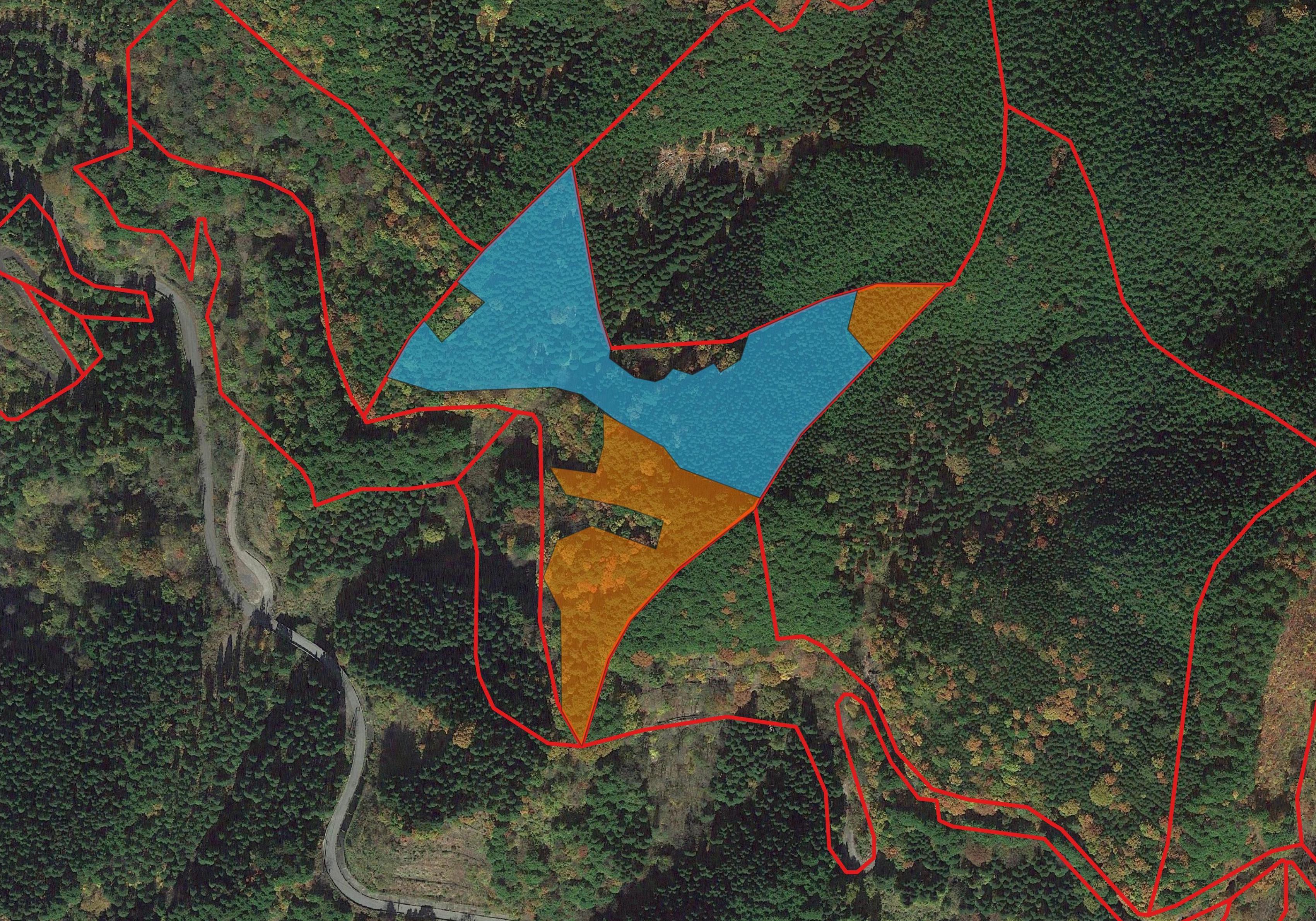
Transforming Forest Management using AI and Machine Learning

Our innovative technology enables precise tree species identification and accurate land surveying, equipping you with the information needed to make informed decisions and effectively manage your valuable forest resources. Experience the future of forest management with Skysense by leveraging the power of drones, aircraft imagery, satellite imagery, and cutting-edge artificial intelligence (AI) to deliver comprehensive forest management solutions.
Unlock the Potential of Forest Management with Skysense:
-
Tree Species Identification: Skysense’s advanced AI algorithms combined with aerial and satellite imagery provide unmatched accuracy in identifying tree species within your forested areas. From conifers to hardwoods, our technology assists in creating detailed species maps, allowing you to better understand the composition of your forest and make informed decisions for sustainable management.
-
Precise Land Surveying: Our aerial and satellite imagery, coupled with AI-powered data analytics, offers precise land surveying capabilities. Skysense helps you gather essential information about topography, boundaries, vegetation coverage, and other crucial factors necessary for effective forest management and land use planning.
-
Timely Decision-Making: Skysense’s real-time monitoring and analysis tools provide you with up-to-date information about your forested areas. Stay informed about potential risks such as disease outbreaks, invasive species, or illegal logging activities. Our technology enables you to respond promptly and proactively to emerging challenges, reducing risks and maximizing forest productivity.
-
Optimized Resource Allocation: By leveraging our comprehensive forest management solutions, you can optimize resource allocation and improve operational efficiency. Skysense’s data-driven insights enable you to identify areas requiring specific attention, prioritize interventions, and allocate resources effectively, resulting in cost savings and improved outcomes.
-
Government Collaboration: Skysense understands the importance of collaboration between private landowners and government agencies in sustainable forest management. Our solutions facilitate seamless communication and data sharing, enabling governments to monitor and regulate forest activities, enforce compliance, and make informed policy decisions.
-
Environmental Stewardship: Skysense is committed to environmental stewardship. By implementing our forest management solutions, you contribute to sustainable practices, conservation efforts, and the preservation of our invaluable forest ecosystems for future generations.

Experience the Power of Skysense’s Forest Management Solutions
Partner with Skysense and unlock the true potential of your forested lands. Our integration of drones, aircraft imagery, satellite imagery, and AI technology revolutionizes the way you manage and monitor your forests. Make informed decisions, protect your valuable resources, and ensure a sustainable future for your land.
Contact Skysense today to discover how our tailored forest management solutions can benefit your specific needs. Together, let’s transform the way we manage and preserve our forests.